

The old post from 2016 wrote:...yesterday I was looking for a solution to geocode some addresses automatically - this means to convert the adresse into the corresponding longitude and latitude coordinates.
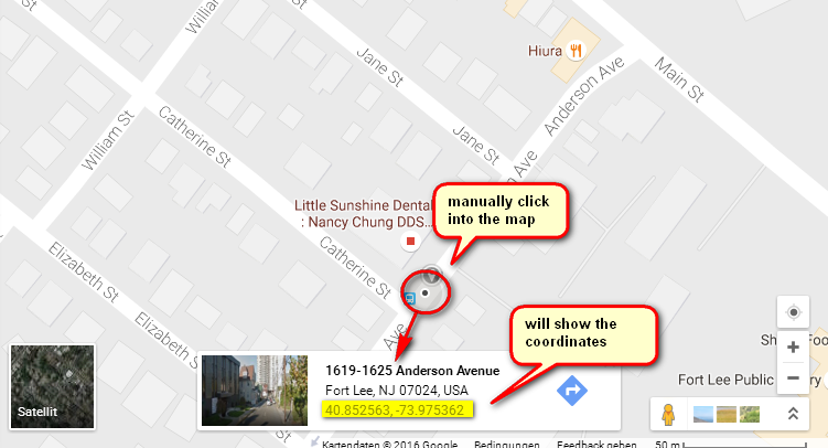
I found some service providers in the web, but they all work with APIs and you have to register and/or to create an account to get an API key. Although most of the services are for free (for less than x conversions per day), but I was looking for a solution without registering anywhere and without the use of an API key. A manual conversion (entering the address in google maps and click somewhere in the map) works just as well in google.
17.04.2019:
I have rewritten the geo coding to Open Streetmap (OSM) now, because there is a defined JSON and XML interface. If the OSM encoding is not successful, Google Maps will be used instead automatically (fallback function).
Alternatively you can use the constants #FORCE_OSM and #FORCE_GOOGLE to force an exclusive geo coding with one of the services. With #FORCE_NOTHING (or by omitting the constant) the module first try to geo code via OSM and, if that doesn't work, it try to geo code via Google Maps.
The module offers one following public function:
Code: Select all
AddressToGeo(sAddress.s, *stOutGeolocation.geolocation, iForceService.i)
; +-----------------------------------------------------------------
; |Description : Encodes an address in longitude and latitude using Open Streetmap (OSM) or Google Maps
; |Arguments   : sAddress : The address to be coded as free text (e.g. "Hauptstraße 5, 10827 Berlin")
; |            : *stOutGeolocation: Structure of type geolocation, which contains the coordinates and those of OSM or
; |              Google Maps gets corrected address
; |            : iForceService : Using the constants #FORCE_OSM and #FORCE_GOOGLE the exclusive
; |              coding can be forced via Open Streetmap or Google Maps. If the
; |              parameter is omitted or #FORCE_NOTHING is specified, then the module first
; |              try to encode via OSM and in case of trouble via Google Maps.
; |    Results : 1, if the query was successful, 0 if there were errors
; |    Remarks : The returned address is the address corrected by OSM resp. Google.
; |              Please note that the structure of the address is different for both!;
+-----------------------------------------------------------------Code: Select all
  UseModule AddressToGeo
  Declare stGeoLoc.geolocation

  InitNetwork()

  If AddressToGeo("505 Foothill Blvd, Claremont, CA 91711, USA", stGeoLoc, #FORCE_NOTHING)
    Debug stGeoLoc\sAddress + ": " + stGeoLoc\sLatitude + ", " + stGeoLoc\sLongitude
  Else
    Debug "Geocoding failed!"
  EndIf
  UnuseModule AddressToGeo
A possible return looks like this:
505, Foothill Boulevard, Claremont, Los Angeles County, California, 91711, USA: 34.1070653667257, -117.722740216992
Code: Select all
Changelog:
;* 1.01 - add 17.04.2019: The primary coding is now done via the JSON
;*                        interface of open Streetmap. Only if this encoding
;*                        fails there is a fallback to Google Maps.
Code: Select all
;*************************************************************************
;* AddressToGeo
;*************************************************************************
;*
;* Modulname         : AddressToGeo
;* Filename          : mod_AddressToGeo.pbi
;* Filetype          : Module [MainApp, Formular, Include, Module, Data]
;* Programming lang. : Purebasic 5.62+
;* String-Format     : Unicode [Ascii, Unicode, All]
;* Platform          : All [Windows, Mac, Linux, All]
;* Processor         : All [x86, x64, All]
;* Compileroptions   : -
;* Version           : 1.01
;* Date              : 17.04.2019
;* Autor             : Kurzer
;* -----------------------------------------------------------------------
;* Description:
;*
;* Get the geographic coordinates from an addresse
;* -----------------------------------------------------------------------
;* Changelog:
;* 1.01 - add 17.04.2019: The primary coding is now done via the JSON
;*                        interface of open Streetmap. Only if this encoding
;*                        fails there is a fallback to Google Maps.
;* 1.00 - rel 15.04.2019: First release
;* -----------------------------------------------------------------------
;* English-Forum     : https://www.purebasic.fr/english/viewtopic.php?f=27&t=66616
;* French-Forum      :
;* German-Forum      : https://www.purebasic.fr/german/viewtopic.php?f=8&t=29821
;* -----------------------------------------------------------------------
;* License: MIT License
;*
;* Copyright (c) 2016/19 Kurzer
;*
;* Permission is hereby granted, free of charge, to any person obtaining a copy
;* of this software and associated documentation files (the "Software"), to deal
;* in the Software without restriction, including without limitation the rights
;* to use, copy, modify, merge, publish, distribute, sublicense, and/or sell
;* copies of the Software, and to permit persons to whom the Software is
;* furnished to do so, subject to the following conditions:
;*
;* The above copyright notice and this permission notice shall be included in all
;* copies or substantial portions of the Software.
;*
;* THE SOFTWARE IS PROVIDED "AS IS", WITHOUT WARRANTY OF ANY KIND, EXPRESS OR
;* IMPLIED, INCLUDING BUT NOT LIMITED TO THE WARRANTIES OF MERCHANTABILITY,
;* FITNESS FOR A PARTICULAR PURPOSE AND NONINFRINGEMENT. IN NO EVENT SHALL THE
;* AUTHORS OR COPYRIGHT HOLDERS BE LIABLE FOR ANY CLAIM, DAMAGES OR OTHER
;* LIABILITY, WHETHER IN AN ACTION OF CONTRACT, TORT OR OTHERWISE, ARISING FROM,
;* OUT OF OR IN CONNECTION WITH THE SOFTWARE OR THE USE OR OTHER DEALINGS IN THE
;* SOFTWARE.
;*
;* ---------------- German translation of the MIT License ----------------
;*
;* MIT Lizenz:
;*
;* Hiermit wird unentgeltlich jeder Person, die eine Kopie der Software und der
;* zugehörigen Dokumentationen (die "Software") erhält, die Erlaubnis erteilt,
;* sie uneingeschränkt zu nutzen, inklusive und ohne Ausnahme mit dem Recht, sie
;* zu verwenden, zu kopieren, zu verändern, zusammenzufügen, zu veröffentlichen,
;* zu verbreiten, zu unterlizenzieren und/oder zu verkaufen, und Personen, denen
;* diese Software überlassen wird, diese Rechte zu verschaffen, unter den folgenden
;* Bedingungen:
;*
;* Der obige Urheberrechtsvermerk und dieser Erlaubnisvermerk sind in allen Kopien
;* oder Teilkopien der Software beizulegen.
;*
;* DIE SOFTWARE WIRD OHNE JEDE AUSDRÜCKLICHE ODER IMPLIZIERTE GARANTIE BEREITGESTELLT,
;* EINSCHLIEßLICH DER GARANTIE ZUR BENUTZUNG FÜR DEN VORGESEHENEN ODER EINEM BESTIMMTEN
;* ZWECK SOWIE JEGLICHER RECHTSVERLETZUNG, JEDOCH NICHT DARAUF BESCHRÄNKT. IN KEINEM
;* FALL SIND DIE AUTOREN ODER COPYRIGHTINHABER FÜR JEGLICHEN SCHADEN ODER SONSTIGE
;* ANSPRÜCHE HAFTBAR ZU MACHEN, OB INFOLGE DER ERFÜLLUNG EINES VERTRAGES, EINES DELIKTES
;* ODER ANDERS IM ZUSAMMENHANG MIT DER SOFTWARE ODER SONSTIGER VERWENDUNG DER SOFTWARE
;* ENTSTANDEN.
;*************************************************************************

DeclareModule AddressToGeo
	;- --- [Module declaration / public elements] ------------------------------------------
	;-

	;*************************************************************************
	;- Compiler directives
	;*************************************************************************
	EnableExplicit

	;*************************************************************************
	;- Constants
	;*************************************************************************
	#FORCE_NOTHING								= 0
	#FORCE_GOOGLE									= 1
	#FORCE_OSM										= 2

	;*************************************************************************
	;- Structures
	;*************************************************************************
	Structure geolocation
		sLatitude.s
		sLongitude.s
		sAddress.s
	EndStructure

	;*************************************************************************
	;- Public Procedures (dec)
	;*************************************************************************
	Declare.i AddressToGeo(sAddress.s, *stOutGeolocation.geolocation, iForceService.i = 0)

EndDeclareModule

Module AddressToGeo
	;-
	;- --- [Module implementation / private elements] -----------------------------------------
	;-

	;*************************************************************************
	;- Constants
	;*************************************************************************
	#OSM_URL											= "https://nominatim.openstreetmap.org/search?q=#ADR#&format=json"
	#GOOGLE_URL										= "https://www.google.de/maps/place/#ADR#"
	#GOOGLE_ADR_STARTDELIMITER 		= ~"\\\"https://www.google.de/maps/preview/place/"
	#GOOGLE_ADR_ENDDELIMITER 			= "/@"
	#GOOGLE_GEO_STARTDELIMITER		= ~"\",null,[null,null,"
	#GOOGLE_GEO_ENDDELIMITER			= "]"

	;*************************************************************************
	;- Private Procedures (imp)
	;*************************************************************************
	Procedure.s GetStringPart(sString.s, sStartDelimiter.s, sEndDelimiter.s, iPartLength=0)
		; +-----------------------------------------------------------------
		; |Description  : Extrahiert aus einem String ein Teilstück, welches durch sStartDelimiter und sEndDelimiter eingeschlossen ist
		; |Arguments    : sString        : String aus dem der Teilstring extrahiert werden soll
		; |             : sStartDelimiter: Linker Begrenzungsstring
		; |             : sEndDelimiter  : Rechter Begrenzungsstring
		; |             : iPartLength    : Wenn > 0, dann wird sEndDelimiter ignoriert und ein Teilstring mit der Länge iPartLength zurückgegeben
		; |Results      : Ermittelter Teilstring bzw. "", wenn sStartDelimiter nicht vorhanden ist oder Fehler auftraten
		; |Remarks      : Kommen die Delimiter mehrfach vor, dann wird nur das erste Auftreten gefunden!
		; +-----------------------------------------------------------------
		Protected.i iPos1, iPos2

		iPos1 = FindString(sString, sStartDelimiter) + Len(sStartDelimiter)
		If iPos1 > 0
			If iPartLength = 0
				iPos2 = FindString(sString, sEndDelimiter, iPos1)
			Else
				iPos2 = iPos1 + iPartLength
			EndIf
			If iPos2 > iPos1
				ProcedureReturn Mid(sString, iPos1, iPos2 - iPos1)
			Else
				ProcedureReturn ""
			EndIf
		Else
			ProcedureReturn ""
		EndIf
	EndProcedure
	Procedure.s AskOSM(sAddress.s)
		; +-----------------------------------------------------------------
		; |Description  : Versucht per Open Streetmap die Längen- und Breitengrade zu sAddress zu ermitteln
		; |Arguments    : sAddress: Adresse als Freitext (z.B. "Hauptstraße 5, 10827 Berlin"
		; |Results      : "", wenn die Abfrage nicht möglich war oder Fehler aufgetreten sind,
		; |               andernfalls ein String nach folgendem Format Latitude#Longitude#Adresse
		; |Remarks      : Die zurückgegebene Adresse ist die von Open Streetmap korrigierte Adresse
		; +-----------------------------------------------------------------
		Protected.i *Buffer
		Protected.s sURL, sResponse

		; Geokodierungsanfrage an Open Streetmap senden
		sURL = ReplaceString(#OSM_URL, "#ADR#", URLEncoder(sAddress, #PB_UTF8))
		*Buffer = ReceiveHTTPMemory(sURL)

		If *Buffer
			sResponse = PeekS(*Buffer, MemorySize(*Buffer), #PB_UTF8|#PB_ByteLength)
			FreeMemory(*Buffer)

			; JSON Daten extrahieren
			If ParseJSON(0, sResponse)
				If JSONArraySize(JSONValue(0)) > 0
					sResponse = GetJSONString(GetJSONMember(GetJSONElement(JSONValue(0), 0), "lat")) + "#"
					sResponse + GetJSONString(GetJSONMember(GetJSONElement(JSONValue(0), 0), "lon")) + "#"
					sResponse + GetJSONString(GetJSONMember(GetJSONElement(JSONValue(0), 0), "display_name"))
					FreeJSON(0)
					ProcedureReturn sResponse
				EndIf
				FreeJSON(0)
			EndIf
		EndIf

		ProcedureReturn ""
	EndProcedure
	Procedure.s AskGoogle(sAddress.s)
		; +-----------------------------------------------------------------
		; |Description  : Versucht per Google Maps die Längen- und Breitengrade zu sAddress zu ermitteln
		; |Arguments    : sAddress: Adresse als Freitext (z.B. "Hauptstraße 5, 10827 Berlin"
		; |Results      : "", wenn die Abfrage nicht möglich war oder Fehler aufgetreten sind,
		; |               andernfalls ein String nach folgendem Format Latitude#Longitude#Adresse
		; |Remarks      : Die zurückgegebene Adresse ist die von Google korrigierte Adresse
		; +-----------------------------------------------------------------
		Protected.i *Buffer
		Protected.s sURL, sResponse, sGoogleAddress

		; Geokodierungsanfrage an Google senden
		sURL = ReplaceString(#GOOGLE_URL, "#ADR#", URLEncoder(sAddress, #PB_UTF8))
		*Buffer = ReceiveHTTPMemory(sURL)

		If *Buffer
			sResponse = PeekS(*Buffer, MemorySize(*Buffer), #PB_UTF8|#PB_ByteLength)
			FreeMemory(*Buffer)
			If FindString(sResponse, #GOOGLE_ADR_STARTDELIMITER)
				sGoogleAddress = URLDecoder(GetStringPart(sResponse, #GOOGLE_ADR_STARTDELIMITER, #GOOGLE_ADR_ENDDELIMITER))
				If sGoogleAddress <> ""
					sResponse = GetStringPart(sResponse, sAddress + #GOOGLE_GEO_STARTDELIMITER, #GOOGLE_GEO_ENDDELIMITER)
					ProcedureReturn ReplaceString(sResponse, ",", "#") + "#" + sGoogleAddress
				EndIf
			EndIf
		EndIf

		ProcedureReturn ""
	EndProcedure

	;*************************************************************************
	;- Public Procedures (imp)
	;*************************************************************************
	Procedure.i AddressToGeo(sAddress.s, *stOutGeolocation.geolocation, iForceService.i = 0)
		; +-----------------------------------------------------------------
		; |Description  : Kodiert mittels Open Streetmap (OSM) bzw. Google Maps eine Adresse in Längen- und Breitengrad
		; |Arguments    : sAddress         : Die zu kodierende Adresse als Freitext (z.B. "Hauptstraße 5, 10827 Berlin")
		; |             : *stOutGeolocation: Struktur vom Typ geolocation, welche die Koordinaten und die von OSM bzw.
		; |                                  Google Maps korrigierte Adresse erhält
		; |             : iForceService    : Über die Konstanten #FORCE_OSM und #FORCE_GOOGLE kann die ausschließliche
		; |                                  Kodierung über Open Streetmap bzw. Google Maps erzwungen werden. Wird der
		; |                                  Parameter weggelassen oder #FORCE_NOTHING angegeben, dann wird zuerst
		; |                                  versucht über OSM zu kodieren und im Fehelrfall dann über Google Maps.
		; |Results      : 1, wenn die Abfrage erfolgreich war, 0 bei Fehlern
		; |Remarks      : Die zurückgegebene Adresse ist die von OSM bzw. Google korrigierte Adresse
		; |               Bitte beachten, dass der Aufbau der Adresse bei beiden unterschiedlich ist!
		; +-----------------------------------------------------------------
		Protected.s sLat, sLng, sGeoString

		Select iForceService
			Case #FORCE_OSM
				; Geokodierungsanfrage nur an Open Streetmap senden
				sGeoString = AskOSM(sAddress.s)
			Case #FORCE_GOOGLE
				; Geokodierungsanfrage nur an Google Maps senden
				sGeoString = AskGoogle(sAddress.s)
			Default
				; Geokodierungsanfrage an Open Streetmap bzw. bei Fehlern an Google Maps senden
				sGeoString = AskOSM(sAddress.s)
				If sGeoString = ""
					sGeoString = AskGoogle(sAddress.s)
				EndIf
		EndSelect

		If sGeoString <> ""
			sLat = StringField(sGeoString, 1, "#")
			sLng = StringField(sGeoString, 2, "#")
			sAddress = StringField(sGeoString, 3, "#")

			If sLat <> "0.0" And sLng <> "0.0"
				*stOutGeolocation\sLatitude = sLat
				*stOutGeolocation\sLongitude = sLng
				*stOutGeolocation\sAddress = sAddress
				ProcedureReturn 1
			EndIf
		EndIf

		ProcedureReturn 0
	EndProcedure
EndModule

;-------------------------------------------------------------------------------
;- Main
CompilerIf #PB_Compiler_IsMainFile
	EnableExplicit

	Procedure Main()
		UseModule AddressToGeo
		Protected stGeoLoc.geolocation
		Protected sAddress.s, iForceService

		InitNetwork()

		iForceService = #FORCE_NOTHING
		;iForceService = #FORCE_GOOGLE
		;iForceService = #FORCE_OSM
		sAddress = "Hauptstrasse 4, 10827 Berlin Deutschland"
		;sAddress = "505 W Foothill Blvd, Claremont, CA 91711, USA"
		If AddressToGeo(sAddress, stGeoLoc, iForceService)
			Debug stGeoLoc\sAddress + ": " + stGeoLoc\sLatitude + ", " + stGeoLoc\sLongitude
		Else
			Debug "Geocoding failed!"
		EndIf

		UnuseModule AddressToGeo
	EndProcedure

	Main()
CompilerEndIf


